
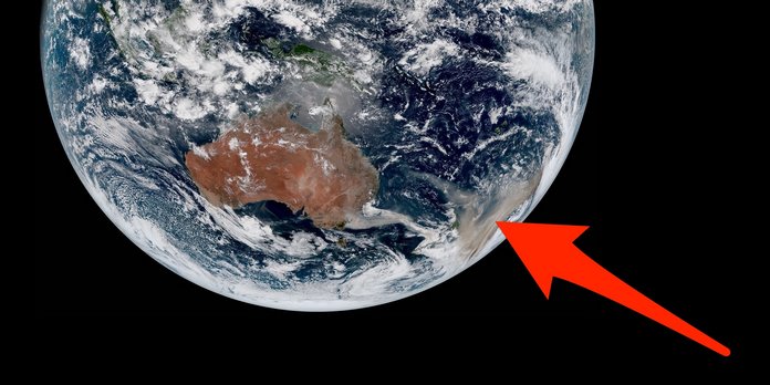
 Wildfires are continuing to spread across Australia, with the country’s government pledging to pay “whatever it takes” to help people and wildlife recover.
 In a Facebook post, a map of Australia’s fires is juxtaposed with a map of the United States, revealing just how massive the inferno is.
 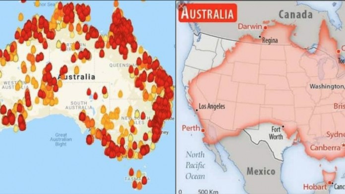 The fatal wildfires sparked in September, burning over 12 million acres of land, scorching over 1,500 homes and killing over 20 people.
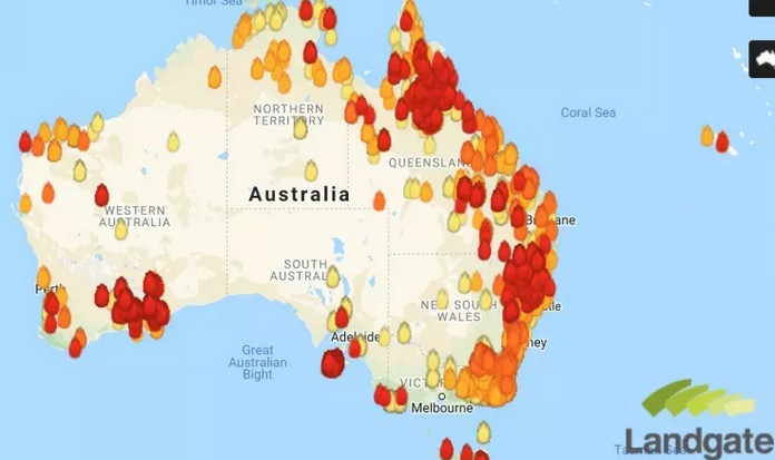
The New South Wales Rural Fire Service reported 146 fires burning across the state with 65 uncontained as of Sunday, according to their Twitter post.


